News in 2025
|
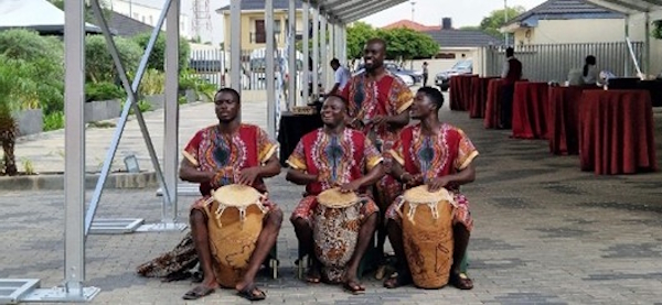
Representatives of national geospatial and mapping authorities and national statistical agencies in Africa, gathered in person for the 11th meeting of the Regional Committee of United Nations Global Geospatial Information Management for Africa (UN-GGIM: Africa). Joined by the survey and geospatial professional community, this event was held alongside the AfricaGIS 2025 conference, making the 5 days meetings and conference a landmark occasion for regional cooperation and progress.
Underscoring Africa’s growing commitment to harnessing geospatial information as a driver of sustainable development, innovation, and resilience. FIG President Diane Dumashie was invited to take part in both meetings, joining other international partners who also hold UN Observer status at the UNGGIM meeting.
Organized collaboratively by UN-GGIM: Africa,
the
Ministry of Lands and Natural Resources of Ghana, the United Nations
Economic Commission for Africa (ECA), the United
Nations Global Geospatial Knowledge and Innovation Centre (UN-GGKIC), the
SDG Data
Alliance, and the UN Committee of Experts on Global
Geospatial Information Management (UN-GGIM), in the Statistics Division, Department
of Economic and Social Affairs. The meeting brought together over 70
participants from 26 African countries. Their presence highlighted the
importance of global collaboration and knowledge-sharing in advancing
Africa’s geospatial agenda.
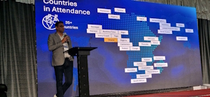 FIG President Dr. Diane Dumashie was invited to deliver
opening
remarks (read here), participate in discussions, and present a
plenary address
(read here). Her
contribution emphasized the role of survey and geospatial professional
communities to bridge geospatial practice with policy, and the need for
integrated approaches to overcome fragmentation in both the geospatial
and broader survey data ecosystems.
FIG President Dr. Diane Dumashie was invited to deliver
opening
remarks (read here), participate in discussions, and present a
plenary address
(read here). Her
contribution emphasized the role of survey and geospatial professional
communities to bridge geospatial practice with policy, and the need for
integrated approaches to overcome fragmentation in both the geospatial
and broader survey data ecosystems.
This theme resonated throughout the week, reinforcing the importance of ambitious partnerships and coordinated efforts to strengthen Africa’s geospatial foundations.
The FIG Ghanaian members were highly visible in the organisation of the conference week. FIG Honorary Member Stephen Djaba (FIG Chair of FIG Task Force Diversity & Inclusion) was co-conference director and local organiser of the Africa GIS2025 conference, helped by FIG Young Surveyor Angela Anyakora, and others.
Licensed Surveyors Association of Ghana (LiSAG) co-hosted AfricaGiS 2025, led by LiSAG President Samuel Larbi Darko. In addition, the FIG Africa Regional Capacity Network (ARN) was formerly represented by FIG Honorary Member FIG Honorary Member Stephen Djaba.
Furthermore, as reflected in other UN-GGIM regional meetings, the attendance of the African FIG member community was clearly evident here. With appreciation, FIG Ghana corporate member Geo-Tech Systems Ltd sponsored 12 students from the FIG Young Surveyors Network to attend. Other FIG corporate members also attended (e.g. ESRI presenting). The presence of FIG community highlighted the impact and importance of global collaboration and knowledge-sharing in the field of geospatial information management.
The meetings were structured to maximise collaboration and knowledge sharing:
This report highlights the collaborative platforms of each.
Speakers opening panel; ECA, UN-IGIF, Chair Africa, African
Statistics/ ECA, African Space Council
|
UN-GGKIC
|
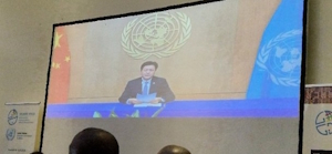
The mission of UN-GGIM: Africa is to mainstream geospatial information into national and regional priorities, positioning this as a pivotal enabler of Africa’s development agendas, for sustainable development and global collaboration. The opening session featured interventions from key leaders including: Mr. Andre Nonguierma, Chief, Geospatial Information Management Section, ECA, Mr. Li Pengde, Director, UN-GGKIC (via video), Mr. Fernand Isseri, Co-Chair, High-Level Group on UN-IGIF, Mr. Clinton Heimann, outgoing Chair of UN-GGIM Africa, Mr. Samuel Annim, Director, African Centre for Statistics, ECA and Dr. Tidiane Ouattara, President of the African Space Council.
Interestingly, two key highlights reflected FIG’s prominent role in this field. First, the African Space Agency underscored the importance of integration of earth observation, navigation and positioning, communication, and astronomy. Combined this forms the foundation of geospatial intelligence. Second, the panel emphasised the urgent need to overcome fragmentation within geospatial and statistical ecosystems. They called for coordinated, integrated approaches; a message echoed in FIG President Diane Dumashie plenary presentation (read here).
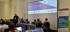
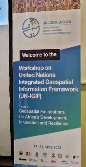 Central
to the week the UN-IGIF Workshop themed “Geospatial Foundations for
Africa’s Development, Innovation and Resilience”. The UN-IGIF provides a
strategic umbrella guiding transformational change in geospatial
information management. It is designed as a living framework, allowing
each member state to adapt and refine it for their specific needs. Above
all it encourages ongoing iterative development across all Member States
ensuring the framework remains relevant and effective.
Central
to the week the UN-IGIF Workshop themed “Geospatial Foundations for
Africa’s Development, Innovation and Resilience”. The UN-IGIF provides a
strategic umbrella guiding transformational change in geospatial
information management. It is designed as a living framework, allowing
each member state to adapt and refine it for their specific needs. Above
all it encourages ongoing iterative development across all Member States
ensuring the framework remains relevant and effective.
Structured over two days, the discussions focused on:
Since 2020, with support from ECA, the SDG Data Alliance, and UN-GGKIC, ten African countries have embarked on UN-IGIF implementation. The workshop highlighted achievements, challenges, and best practices, while underscoring the need for continued assistance to raise awareness and develop national strategies.
Delegates explored how geospatial information can accelerate progress toward the Sustainable Development Goals (SDGs), emphasizing the importance of leadership, collaboration, and national circumstances in shaping effective strategies.
UN-IGIF workshop particpants
|
Implementing UN-IGIF across 10 African member states
|
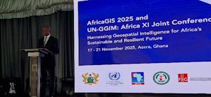
AfricaGIS 2025 was convened alongside the UN-GGIM: Africa. Organised by EIS Africa, a Cape Town based organisation led by Sives Govender, it was co-hosted by Ghana Land Commission and LiSAG with the President Ing. Dr. Samuel Larbi Darko chairing the Local Organising Committee (LOC) assisted by Jones Ofori Boadu, technical director at the Ministry of Lands and Natural Resources of Ghana.
The conference sought to elevate advocacy by engaging a broad spectrum of experts, academics, policymakers, civil society, and the private sector, in robust dialogues on national and regional geospatial policies, emerging technologies, and the ethical use of data. To ensure partial integration of UN-GGIM: Africa members into the parallel conference, joint plenaries were convened. The conference opening three featured welcome remarks and introductions from distinguished leaders, including the FIG President, as listed in the AfricaGis conference programme.
Opening remarks from Deputy Minister Hon Alhaji Y Sulemana
|
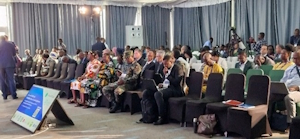
Conference participants
|
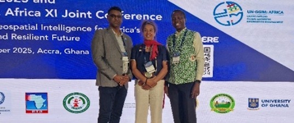
From left: UN-IGIF co-conference director Siver Govender, FIG President Diane Dumashi, and co-conference director Stephen Djaba
The implementation of the SDGs is lagging (UN Habitat 2025 SDG report), prompting urgent calls for improved financing mechanisms, equity, and integrated implementation strategies for the implementation of the 2030 Agenda. Conference sessions covered a wide range of topics, all demonstrating the transformative potential of geospatial information. A recurrent theme can be observed in global discussions and highlighted at this meeting. Namely, the urgent need to close what is becoming a persistent digital divide. It was emphasised that digital public infrastructure and data play the critical role as drivers of inclusive digital transformation and innovation.
High-quality, timely, reliable, and disaggregated data, including geospatial information and Earth observations, was recognised as essential to measure, track, and report progress on the SDGs. Such data provides actionable knowledge to policymakers and decision-makers, particularly in developing countries where persistent challenges hinder advancement toward the 2030 Agenda.
Geospatial information was reaffirmed as a crucial cornerstone of national digital public infrastructure, enabling integrated government services that contribute to economic growth, national security, sustainable social development, environmental resilience, and nationwide prosperity.
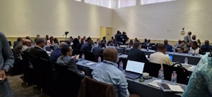
 The
formal segment of the meeting with fully engaged country members
presenting and discussing with interventions allowed from observers.
Matters addressed administrative business, crucial operational issues
and challenges encountered by UN-GGIM: Africa, encompassing leadership
and governance hurdles, framework and infrastructure obstacles. The
meeting reaffirmed the criticality of establishing a comprehensive
geospatial governance framework and the need to seek and designate an
African geospatial champion.
The
formal segment of the meeting with fully engaged country members
presenting and discussing with interventions allowed from observers.
Matters addressed administrative business, crucial operational issues
and challenges encountered by UN-GGIM: Africa, encompassing leadership
and governance hurdles, framework and infrastructure obstacles. The
meeting reaffirmed the criticality of establishing a comprehensive
geospatial governance framework and the need to seek and designate an
African geospatial champion.
In addition, congratulations of the election of the new UN-GGIM: Africa chair Kamal Outghouliast from Morocco. He will be supported by the first vice chair from Burkina Faso, second vice chair from Mozambique, first rapporteur from Burundi, second rapporteur from the Republic of Congo, and ex-officio member from Ethiopia.
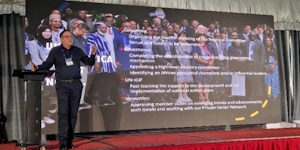
Delegates expressed appreciation to the outgoing UN-GGIM: Africa chair Mr. Clinton Heimann from South Africa (pictured above with photo slide of the 2025 member countries attending), and acknowledged the significant contributions of the ECA Secretariat, led by Mr. Andre Nonguierma in advancing UN-GGIM: Africa’s work.
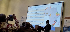
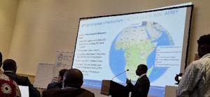 Of
particular note was the review of progress across the committees four
working groups (read
more), which intersect with FIG’s commission priorities: Integrated
Geospatial Information Framework (IGIF); Geodetic infrastructures
(AFREF); Land administration and management (LMIS), and Integration of
Geospatial Information and Statistics (GSFS). Pictured on the right:
Africa member country involvement in AFREF.
Of
particular note was the review of progress across the committees four
working groups (read
more), which intersect with FIG’s commission priorities: Integrated
Geospatial Information Framework (IGIF); Geodetic infrastructures
(AFREF); Land administration and management (LMIS), and Integration of
Geospatial Information and Statistics (GSFS). Pictured on the right:
Africa member country involvement in AFREF.
Throughout the week, emerging regional level discussion themes that are central to Africa’s geospatial future included:
Strengthening global and regional synergies to amplify Africa’s voice and share experiences internationally.
Integrating geospatial information into policy and development frameworks, including climate action, urban planning, and crisis resilience.
Promoting ethical use of emerging data forms, while harnessing artificial intelligence and advanced cartographic techniques.
Building professional capacity and generational renewal, ensuring young surveyors and geospatial professionals are empowered to lead future initiatives.
Considered as a successful and informative meeting, the joint convening of UN-GGIM: Africa and AfricaGIS 2025 in Accra, Ghana, marked a significant event in regional cooperation. By uniting national authorities, professional communities, and international partners, the meeting reinforced Africa’s commitment to leveraging geospatial information for sustainable development.
FIG’s active participation underscored the importance of professional practice in shaping policy and advancing integrated approaches. The outcomes of the week—new leadership, strengthened partnerships, and renewed momentum for UN-IGIF implementation—signal a promising trajectory for Africa’s geospatial community.
As Africa continues to build resilience and innovation through geospatial intelligence, collaboration across borders and disciplines will remain the cornerstone of progress. The Accra meeting demonstrated that when nations, institutions, and professionals work together, geospatial information becomes not just a technical tool, but a transformative force for inclusive and sustainable development.

UN-GGIM: Africa and AfricaGIS 2025 joint closing dinner
FIG President Diane Dumashie
Published 15 December 2025